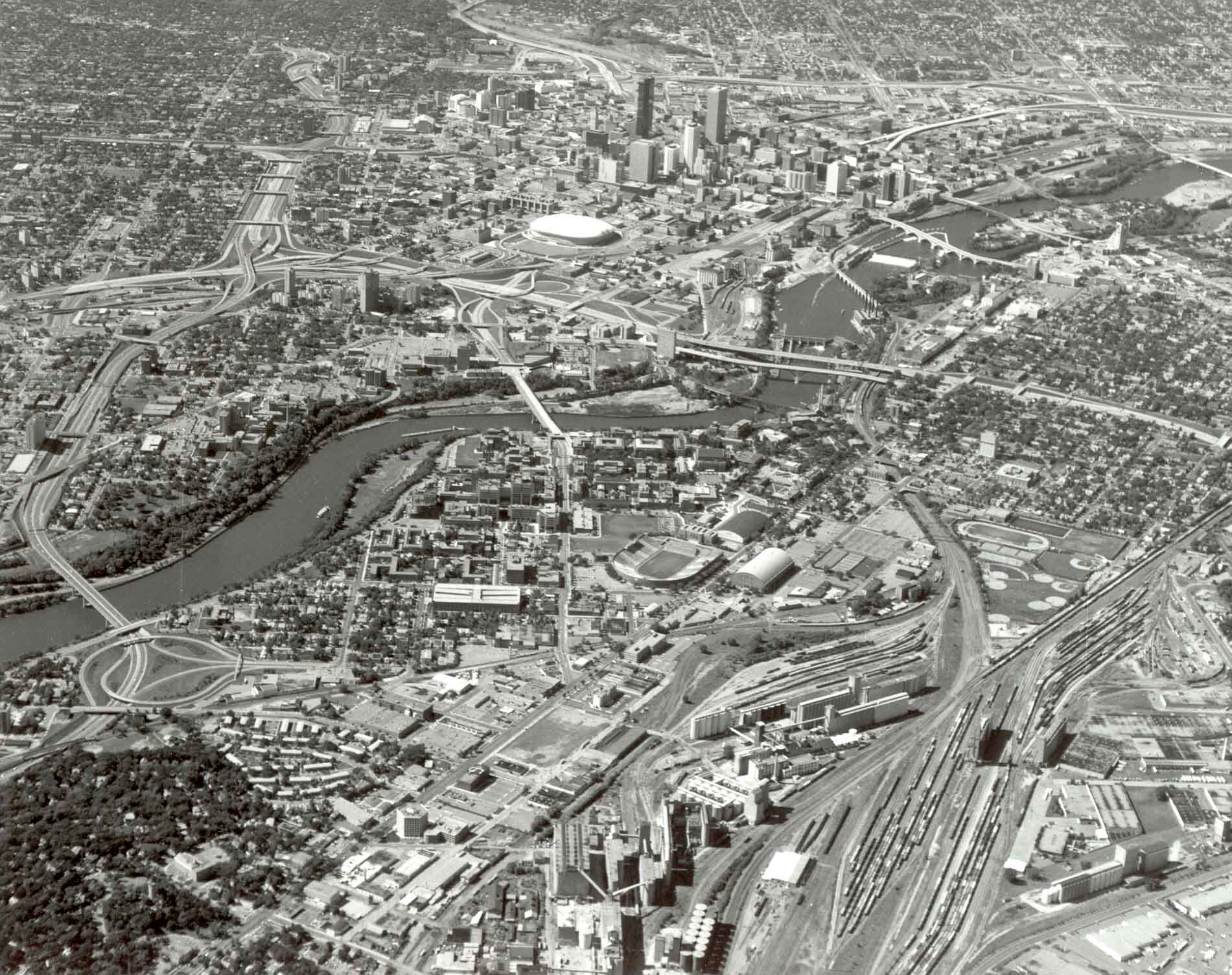
Central Minneapolis, viewed from east to west in 1983, was in transition. The falls of St. Anthony-constrained by dams and concrete aprons, bypassed by locks-and the historic bridging point at Nicollet Island lie upstream from the center of the picture. The transcontinental rail corridor was busy, but large old yards were being abandoned in response to changes in railroading and pressure for redevelopment. Once a child of the falls and rail lines, the downtown had become a focus in the freeway system and the locus of massive new construction and rehabilitation. The expanded University of Minnesota campus straddled the river between the downtown and the major concentration of grain elevators (foreground). Aerial photo by K. Bordner Consultants, Inc., Minneapolis, MN.