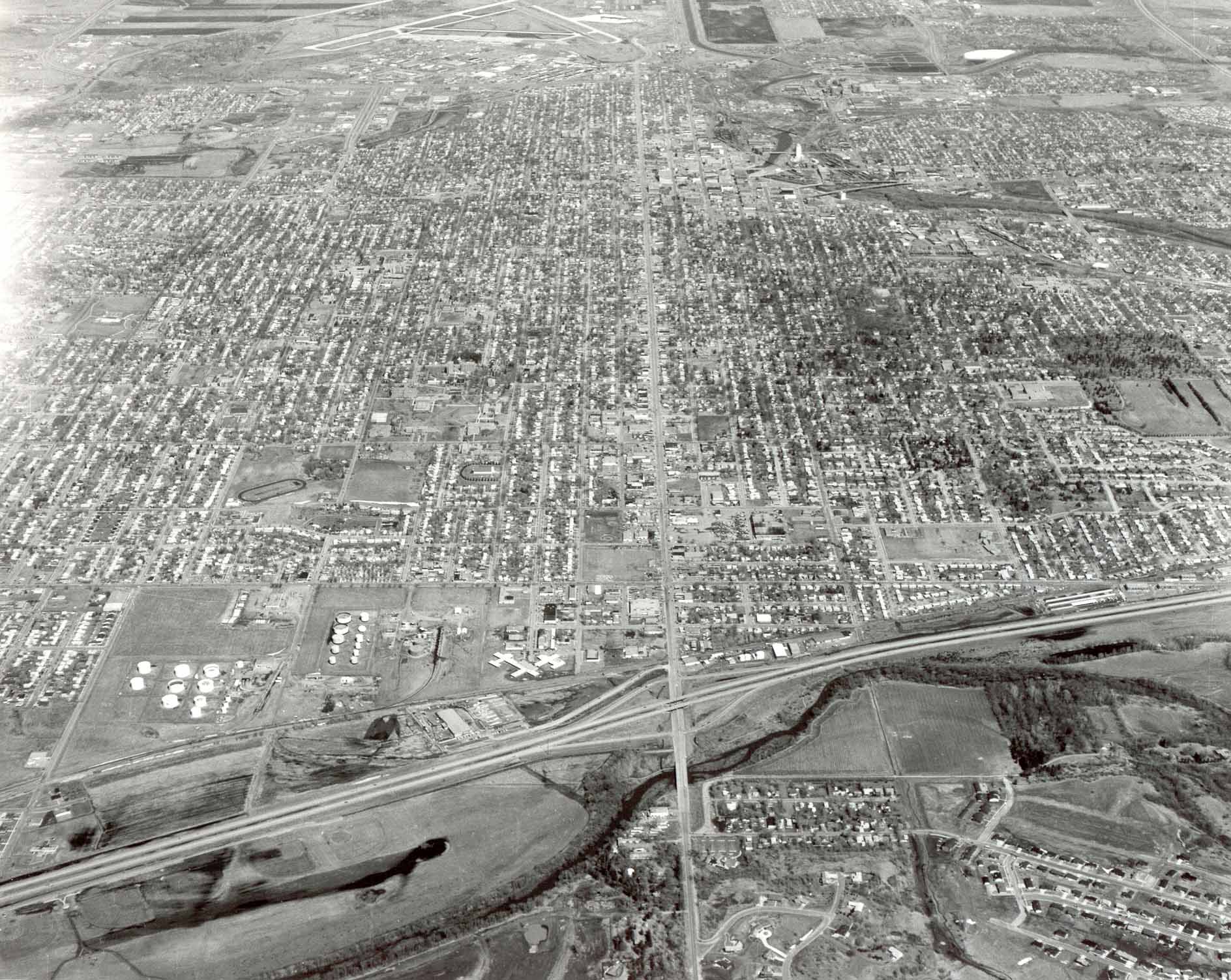
Sioux Falls, South Dakota, 1979, spreads from the south loop of the Big Sioux River and the south freeway bypass (lower edge) to the northwest airport-industrial area (upper left). Rail-era downtown district and industries developed at an early river crossing point upstream from the falls (upper center). Aerial photo by K. Bordner Consultants, Inc., Minneapolis, MN.